I create maps that tell stories, share information, and cultivate curiosity about the world and our place within it.
Maps are a balance of form (beauty, style, aesthetics) and function (navigation, information, storytelling). I create maps for publications, organizations, and individuals, and most recently have been making maps with the team at NOAA Climate.gov.

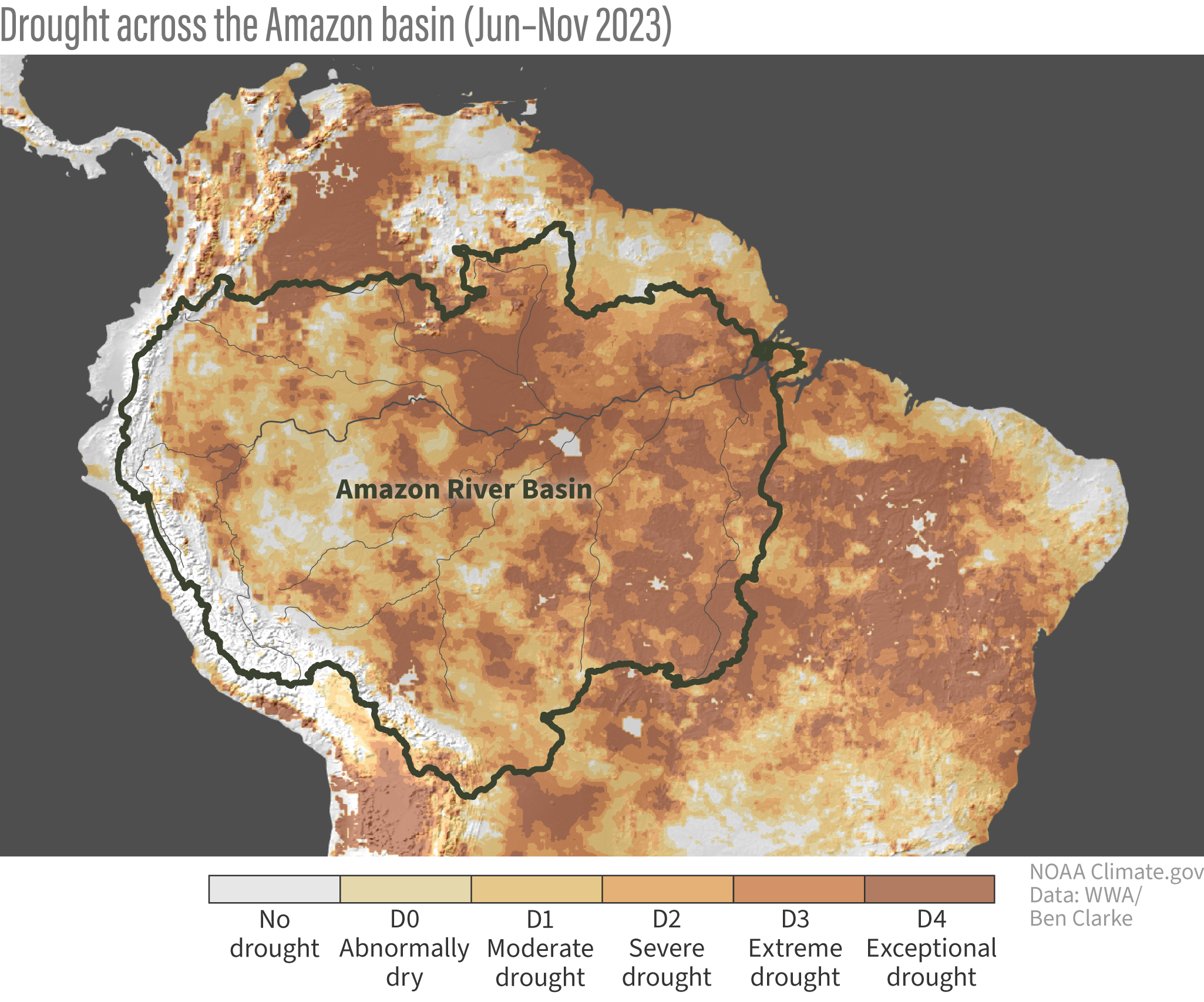
Locator map for the Amazon River Basin and a map of drought across the area in June–November, 2023. Created with the team at NOAA Climate.gov for the article Preliminary analysis says global warming more to blame than El Niño for Amazon’s ongoing record drought.

Migration routes, breeding areas, and wintering areas of the Lesser, Canadian, and Greater populations of Pacific sandhill cranes. Four maps created for author, photographer, and educator Robert Steelquist. View more »
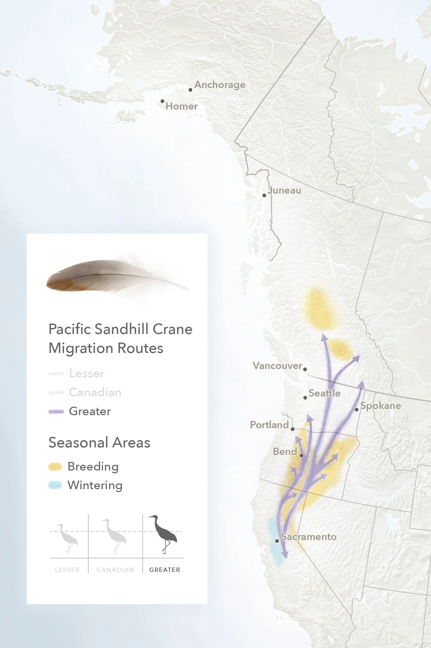
Greater sandhill crane route. View more »

Lesser sandhill crane route. View more »
Video created with the team at Climate.gov using Illustrator and Adobe After Effects for the article What’s the hottest Earth’s ever been?.

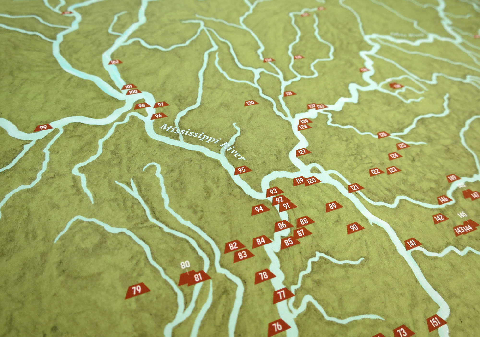
This 24”x36” print depicts a selection of pre-Columbian archaeological sites. Created in collaboration with Kristi Pfeffer. View more »

24”x36” printed map. View more »

Detail of the waterways and sites along the Mississippi River. View more »

This map sheds light on the names, ages, and backgrounds of seven young people - all people of color - who drowned in 2019 in the Rockaways, New York. View more »

Map within the New York Times piece How One Shoreline Took the Lives of Seven Young People.

Version of the map designed for viewing on a mobile device.

Series of five maps featuring urban hikes in New York City’s boroughs for a New York Times interactive piece. View more »

The Giraffe Path (Manhattan). View more »

Yellow Trail of the Staten Island Greenbelt (Staten Island). View more »


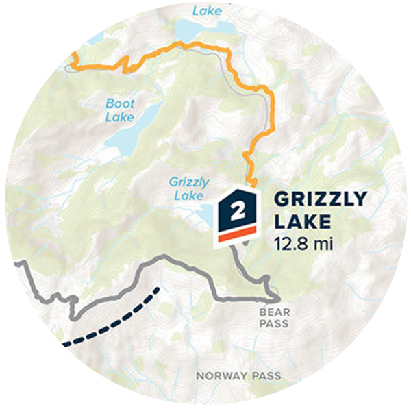
Map of Garnet Point Trail created for a Colorado resident who has walked this favorite trail for many years. View more »

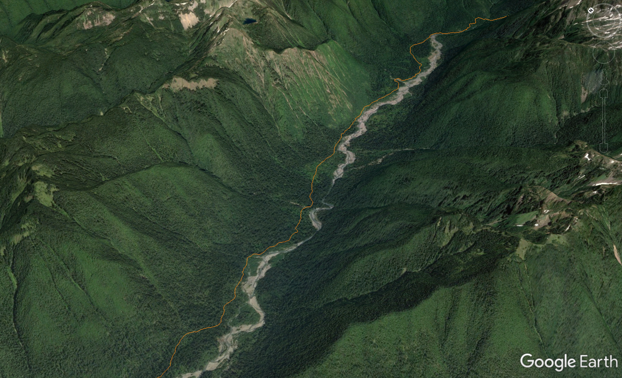
Map of the Oregon section of the Pacific Crest Trail. View more »
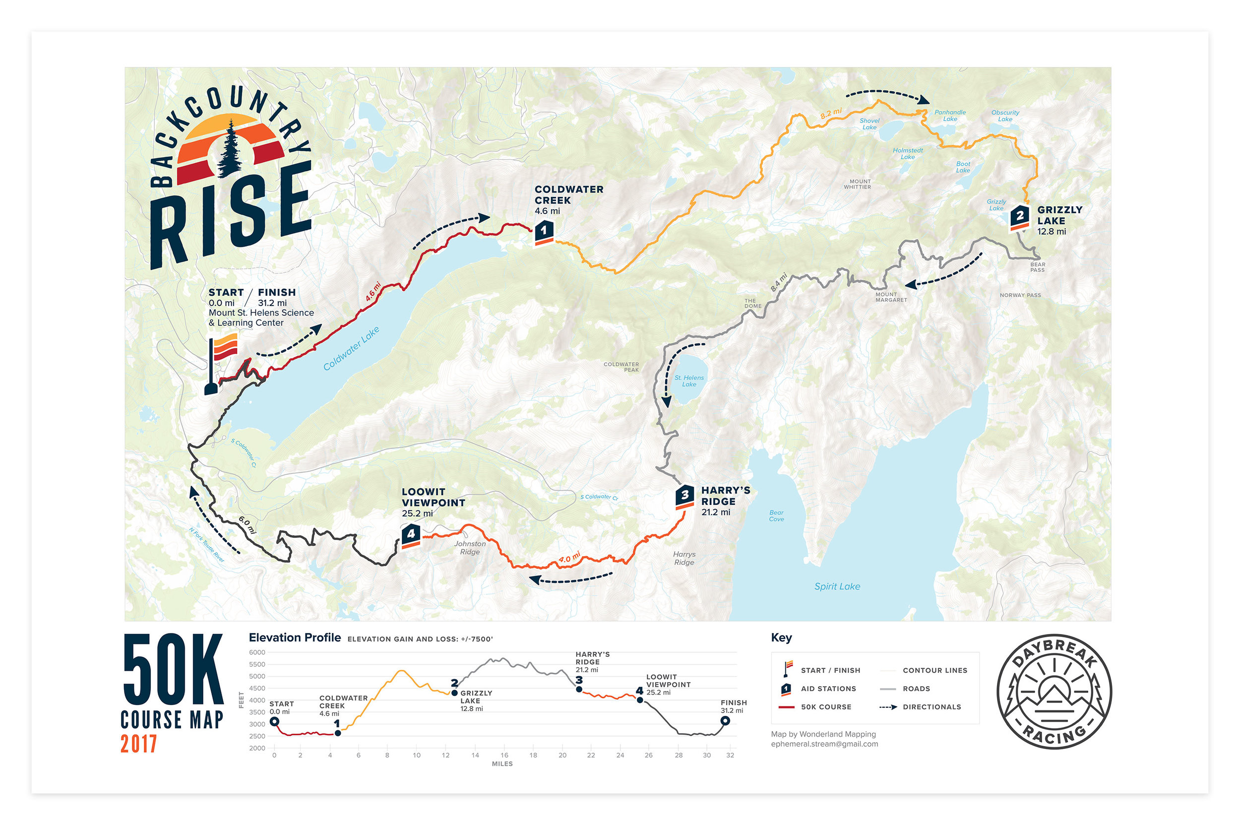
Daybreak Racing’s Backcountry Rise course maps and elevation profiles. View more »
Rainshadow Running’s Oregon Coast 50K.
Detail of the Cascade Lake area for Rainshadow Running’s Orcas Island 100.
Rainshadow Running’s Oregon Coast 30K/50K and Cape Perpetua detail.
Detail of Rainshadow Running’s Orcas Island 100 course.
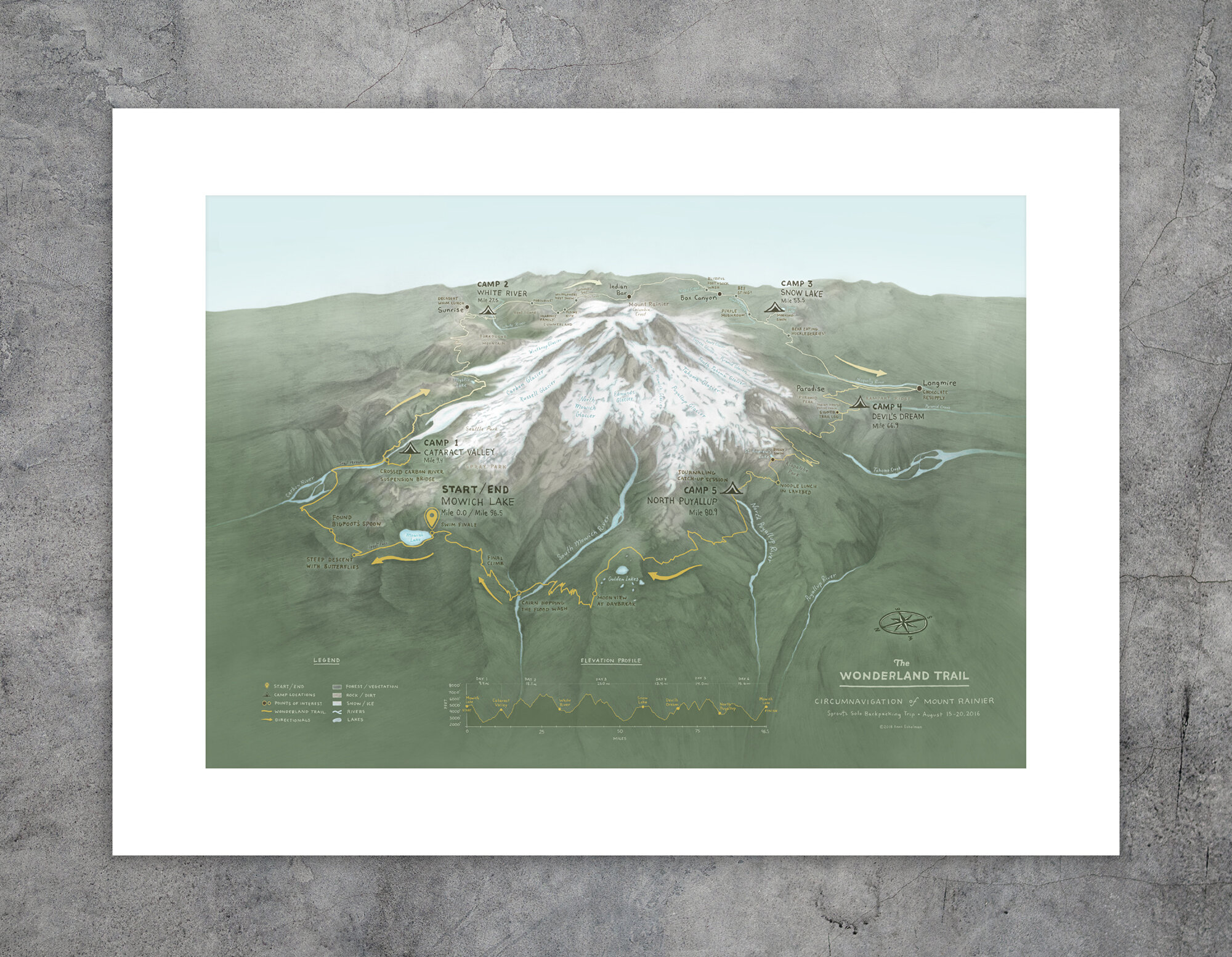
The Wonderland Trail: Circumnavigation of Mount Rainier. A map and elevation profile of my 5-night solo backpacking trip. Pencil and digital color. View more »

Pacific Northwest Vegetation Zones. Map for the 3rd edition of Gardening with Native Plants (Kruckeberg, Chalker-Scott). In previous editions, this map was in black and white and called for a refresh. I created a custom color palette for 10 zones (plus the ocean), re-created zone boundaries, added labels for more context, and cleaned up the layout.

Ocean Currents. Map series illustrating concepts in the book Wildlife Spectacles published by Timber Press. View more »

Plains. View more »

Prairies. View more »

Major flyways. View more »

Butterfly migration. View more »

Coffee, travel, and community: a Nicaragua trip itinerary map created for Equal Exchange blog and newsletter. Map vector and bean illustration provided by the Equal Exchange creative team.

Map of the Ruth Bancroft Garden for The Bold Dry Garden published by Timber Press. View more »
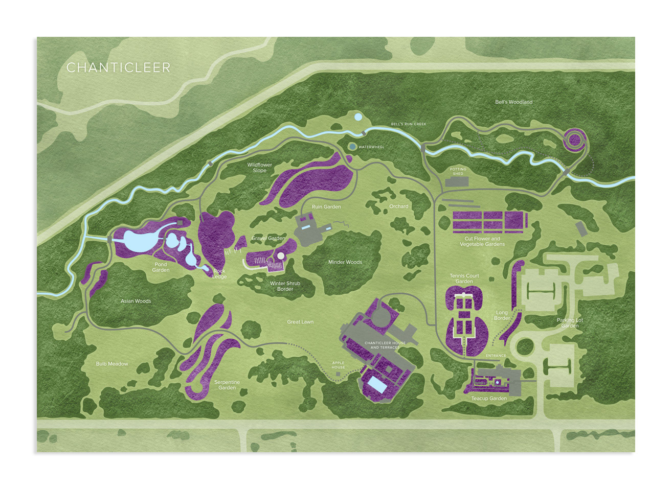
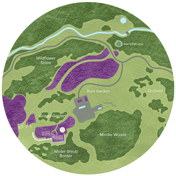
Map of Chanticleer Garden. Printed as endpapers for The Art of Gardening published by Timber Press. View more »

Map of the extent of the most recent ice sheet. Created for Nature’s Temples published by Timber Press. View more »
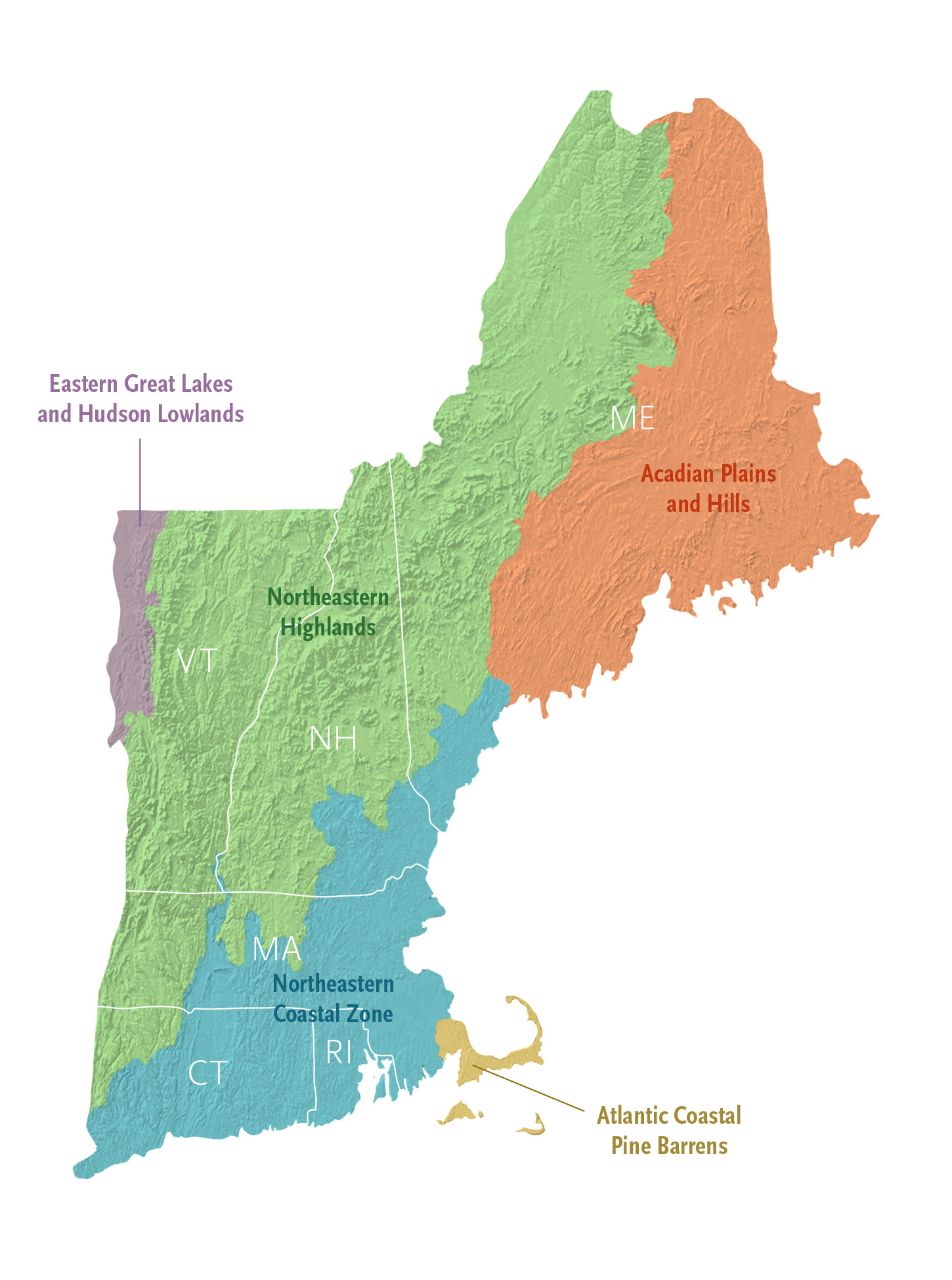
Ecoregions of New England. Created for Wildflowers of New England (A Timber Press Field Guide). View more »
Create a Map
Race Maps
Trail runs, ultramarathons, and other events
Reference maps
For gardens, parks, and natural areas

Thematic Maps
For books, magazines, online or print publications

Fine Art Maps
Prints for your home, organization, school, or office

Commemorative Maps
Remember a special hike, trip, or event

[ Your Idea Here! ]
Want an installation? A custom creation? Let’s chat!